


Nezperce Voting District, Lewis County, Idaho
About
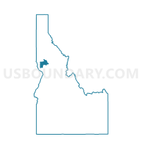
Outline

Summary
| Unique Area Identifier | 564252 |
| Name | Nezperce Voting District |
| County | Lewis County |
| State | Idaho |
| Area (square miles) | 126.68 |
| Land Area (square miles) | 126.59 |
| Water Area (square miles) | 0.09 |
| % of Land Area | 99.93 |
| % of Water Area | 0.07 |
| Latitude of the Internal Point | 46.27320430 |
| Longtitude of the Internal Point | -116.23342810 |
Maps


Graphs
Select a template below for downloading or customizing gragh for Nezperce Voting District, Lewis County, Idaho


Neighbors
Neighoring Voting District (by Name) Neighboring Voting District on the Map
- 4 Orofino Voting District, Clearwater County, ID
- 6 Fraser Voting District, Clearwater County, ID
- 7 Greer Voting District, Clearwater County, ID
- Big Butte Voting District, Idaho County, ID
- Craigmont Voting District, Lewis County, ID
- Ferdinand Voting District, Idaho County, ID
- Greencreek Voting District, Idaho County, ID
- Kamiah Voting District, Idaho County, ID
- Mohler Voting District, Lewis County, ID
- West Kamiah Voting District, Lewis County, ID
Top 10 Neighboring County Subdivision (by Population) Neighboring County Subdivision on the Map
- Nez Perce CCD, Clearwater County, ID (5,721)
- Nez Perce CCD, Idaho County, ID (4,330)
- Kamiah CCD, Lewis County, ID (1,727)
- Craigmont CCD, Lewis County, ID (726)
- Nezperce CCD, Lewis County, ID (685)
Top 10 Neighboring Place (by Population) Neighboring Place on the Map
Top 10 Neighboring Unified School District (by Population) Neighboring Unified School District on the Map
- Orofino Joint School District 171, ID (8,993)
- Kamiah Joint School District 304, ID (3,927)
- Cottonwood Joint School District 242, ID (2,675)
- Highland Joint School District 305, ID (1,475)
- Nezperce Joint School District 302, ID (940)
Top 10 Neighboring State Legislative District Lower Chamber (by Population) Neighboring State Legislative District Lower Chamber on the Map
Top 10 Neighboring State Legislative District Upper Chamber (by Population) Neighboring State Legislative District Upper Chamber on the Map
Top 10 Neighboring 111th Congressional District (by Population) Neighboring 111th Congressional District on the Map
Top 10 Neighboring Census Tract (by Population) Neighboring Census Tract on the Map
- Census Tract 9400, Clearwater County, ID (5,721)
- Census Tract 9400, Idaho County, ID (4,330)
- Census Tract 9400.02, Lewis County, ID (2,058)
- Census Tract 9400.01, Lewis County, ID (1,727)
Top 10 Neighboring 5-Digit ZIP Code Tabulation Area (by Population) Neighboring 5-Digit ZIP Code Tabulation Area on the Map
- 83544, ID (6,092)
- 83536, ID (4,230)
- 83522, ID (2,215)
- 83523, ID (759)
- 83543, ID (717)
- 83526, ID (278)
- 83533, ID (178)